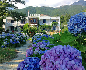
The western end of the island, beyond Kamariotissa, is an interesting area in terms of landscape, but also of the ecosystem it hosts. If you're looking to discover a different side of Samothraki, beyond the popular beach of Pachia Ammos or the famous waterfalls of Fonias, this is a place well worth exploring.
To do a complete tour you will need about 1.5-2 hours and comfortable shoes that allow you to easily step over the rocks. Take a coat with you to protect you from the winds that frequently blow in these parts.
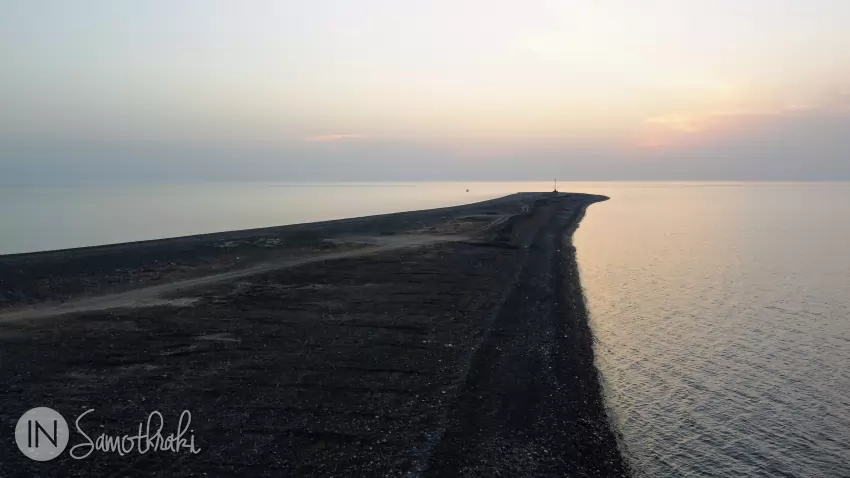
Akrotiri Cape
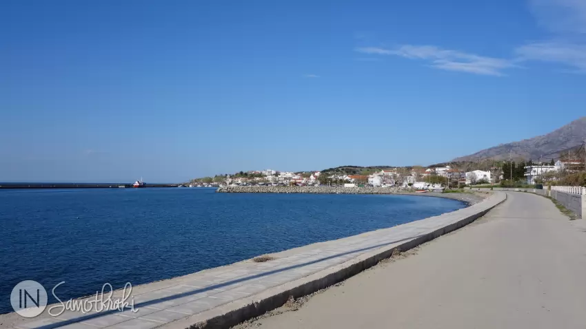
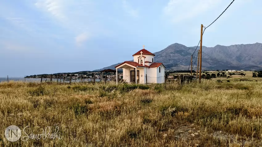
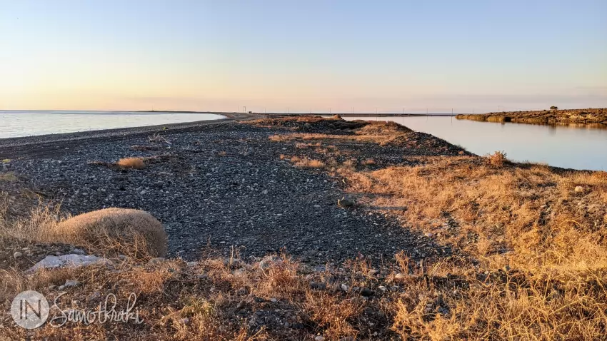
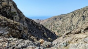
From the ferry port, head west, away from the town. You will walk about 1 km (about 15 minutes) on the sidewalk that accompanies the paved road, passing the fishing port, until you reach an intersection where you will see a church ahead. The church is new, built in 2001 and is named after Saint Nicholas (Agios Nikolaos). The road climbs past it, above the rocky beach (the so-called Mavra Vrachia - "Black Rocks") and turns into a dirt road.
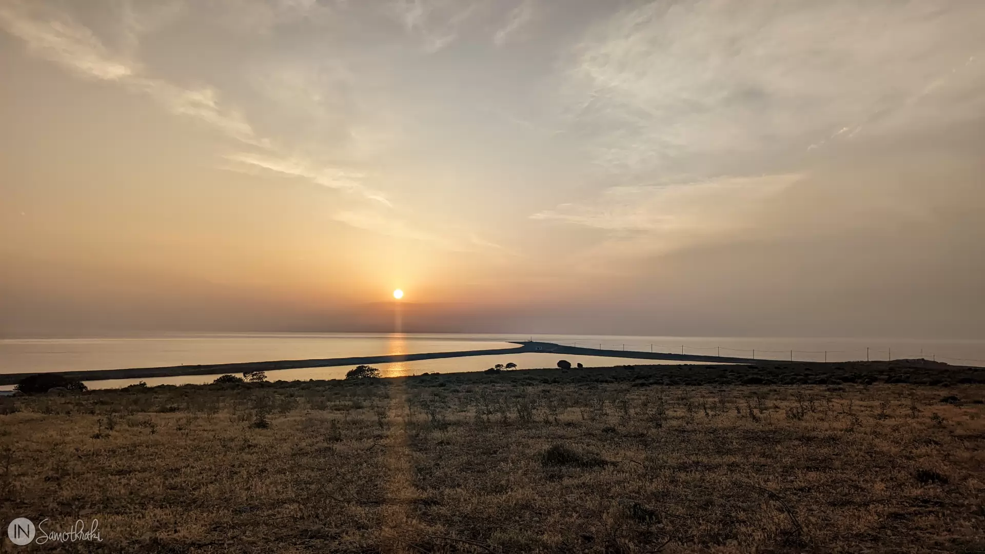
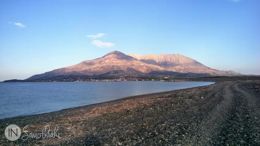
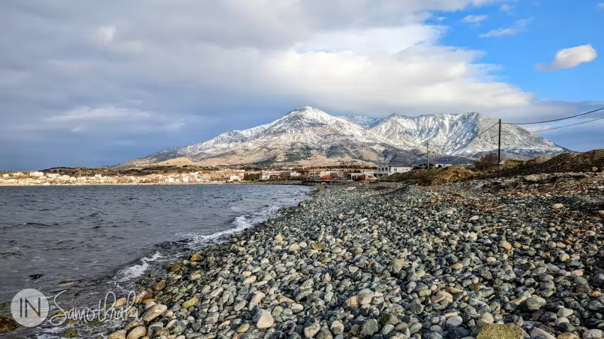
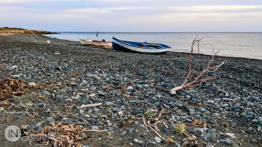
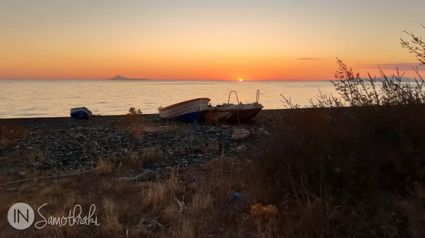
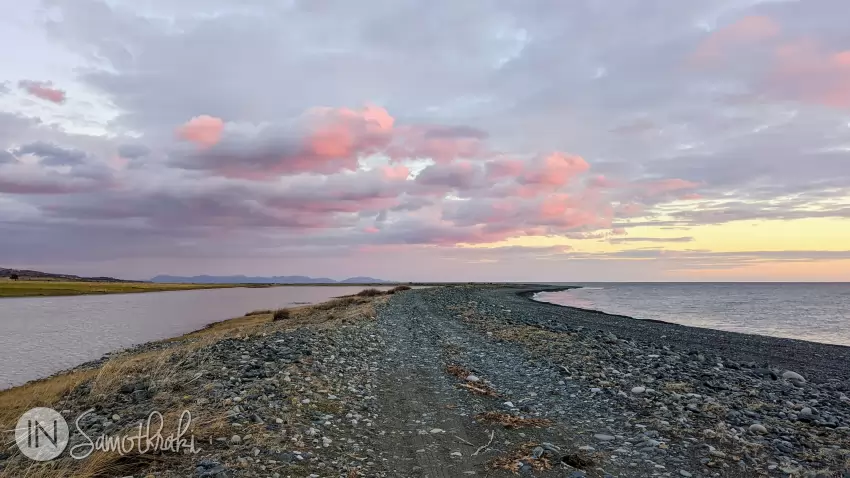
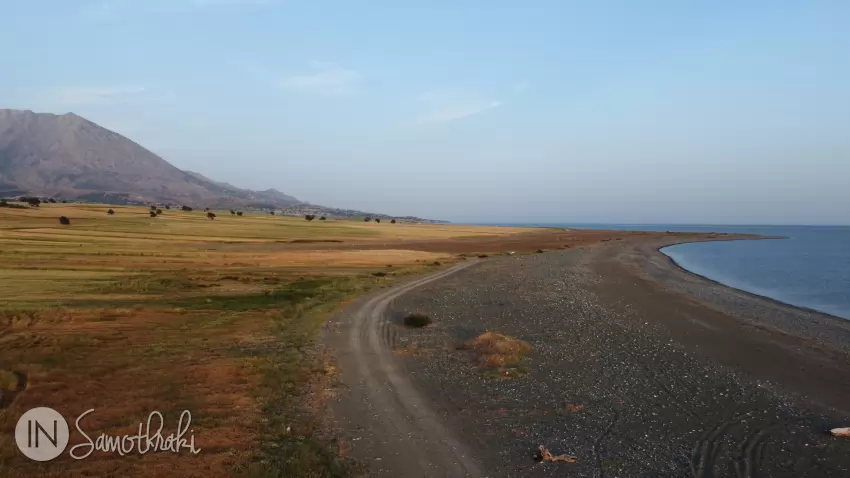
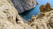
Another 600m and you will have the lagoon of Agios Andreas on your left. Continuing on, you will find yourself on the cape of Akrotiri (also called Agios Andreas), a narrow tongue of land that juts out deep into the sea that now surrounds you on three sides. It is the westernmost point of Samothraki and is the longest and most interesting promontory. It was formed due to the action of strong winds that blow, especially during winter, from opposite directions - northwest and southeast, leading to the transport and accumulation of material
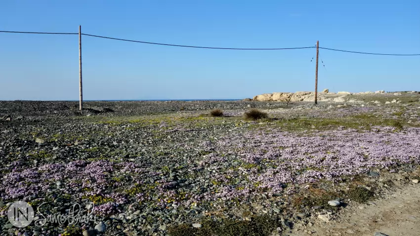
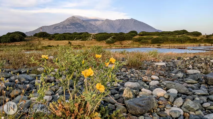
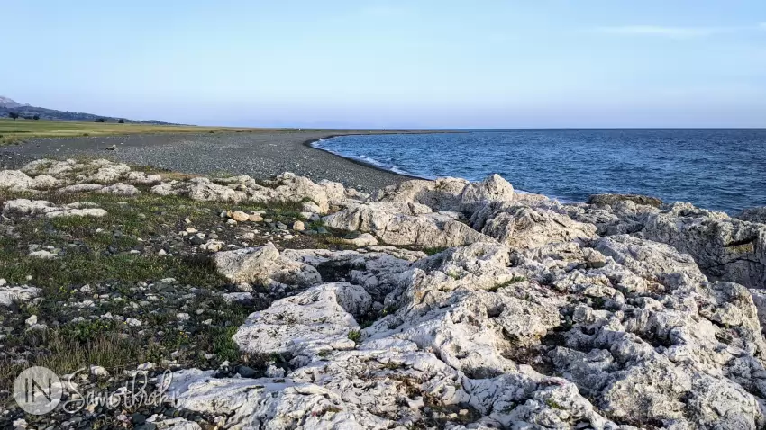
The landscape is dominated by the blue of the sea and the grey of the gravel. During spring, some patches are covered with a carpet of small, yellow and purple flowers.
Cape Akrotiri gives rise to strong currents, dangerous for boats that try to go around it too close to the shore. This fact is also reflected in the island's folklore. "May you drown, and may the waves wash you ashore right on Cape Akrotiri!", "May the winds blow you in the waves of Akrotiri!", "May you be tied to Cape Akrotiri and may the winds blow you from all sides!" - these are some of the popular curses of Samothraki.
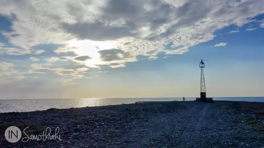
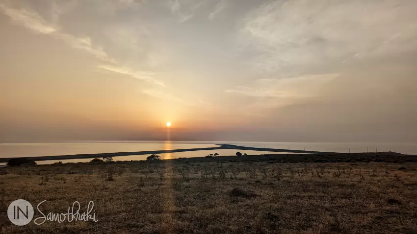
Until 2007, there were four wind turbines on this strip of land. Today, only the lighthouse remains, at the end of the promontory.
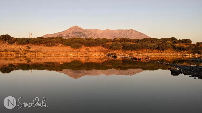
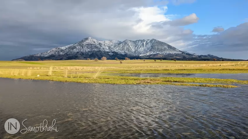
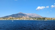
If you turn your gaze towards the island, you will notice a different perspective of Mount Saos.
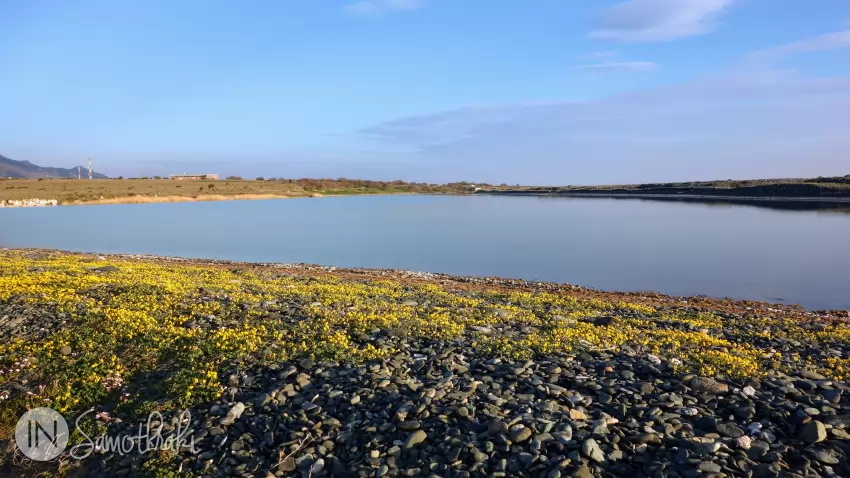
Agios Andreas Lagoon
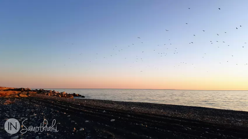
Agios Andreas Lagoon is the most important wetland in Samothraki and has been designated a specially protected area. The place is ideal for birdwatchers, as many species of migratory birds stop here for a rest. Among them are storks, herons, egrets, cormorants, plovers, gulls, birds of prey, coots and, more rarely, pelicans and swans.
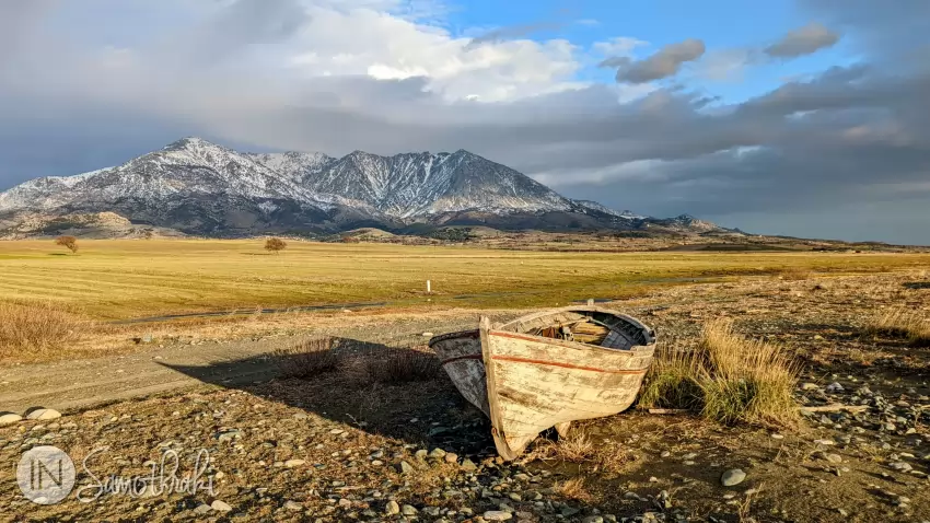
To reach the lagoon, turn around and follow the southern shore of Cape Akrotiri, descending to the right. Soon you will find yourself between two expanses of water - the sea on the right, and to the left the lagoon, on the surface of which Mount Saos is reflected - beautiful at sunset.
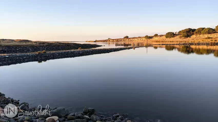
The Agios Andreas lagoon has an area of about 500 m² and a maximum depth of 5m. It is also called taliani (or daliani), meaning "place with fish". There are not many fish in the lagoon anymore, but the locals say that the sea waters in this part are a good place to fish, especially for octopus.
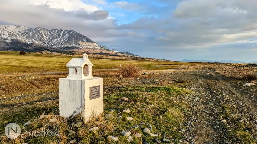
Continuing along the lagoon, just after you get to the end (and to an ugly fence, with shacks, animals and all sorts of debris), you will come across a small white church, with a door painted blue. It is the Agios Andreas church, built in 1871 by a priest. Its walls have been embedded with old fragments of pillars, visible around the entrance. A building, also painted in the same colors, is attached to the church, making them almost indistinguishable as separate structures. It was used by shepherds and fishermen, as a shelter in bad weather or as a storehouse for fodder or tools.
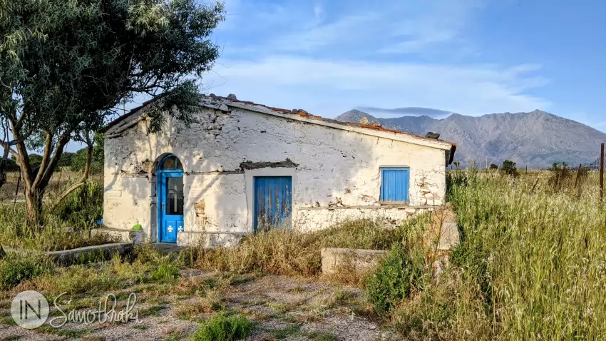
You are in the area where the ancient port of Dimitrion, built around the 6th century BC, is believed to have existed. The fragments and slabs that exist under the waters here support this fact. According to a German archaeologist, the temple of Demeter was once located where the small church of Agios Andreas stands today. Before the modern port of Kamariotissa was built, in bad weather, boats coming from Alexandroupoli would anchor at Agios Andreas, a few meters from the shore.
From here you can return on the dirt road to the right of the church or you can continue along the shore, to the beach of Agios Andreas, passing an area with beautiful rocks. In winter and spring, a few dozen meters from the sea, Lake Koufki forms, with a depth of about one meter, which dries up in the summer. It is another wetland in Samothraki that gathers a large number of birds.
Another dirt road joins the one that leaves from the church of Agios Andreas and takes you back to the asphalt road in Kamariotissa.

 The Waterfalls and Vathres of Samothraki
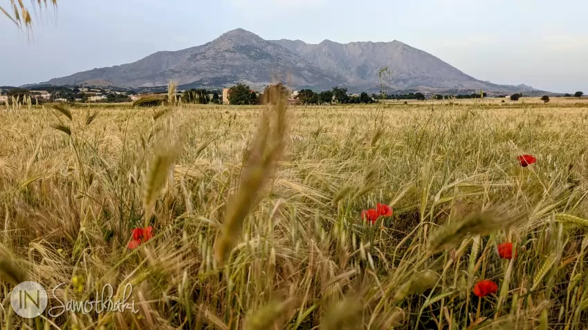
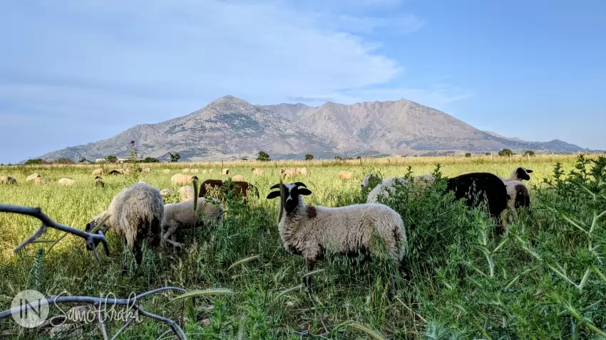
 Mount Saos of Samothraki
 Boat Trips in Samothraki
 11 Things to Do in Samothraki
 Hiking the Fonias River Up to the Kleidosi Waterfall