


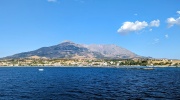
Fengari (Feggari) is the highest peak of Mount Saos on the island of Samothraki. Rising to 1,611m, it is the third-highest peak in the Aegean Sea, following Crete (Mount Psiloritis, 2,456m) and Evia (Mount Dirfys, 1,743m).
The summit of Fengari has been famous since antiquity. In the Iliad, Homer describes how Poseidon, the god of the sea, watched the Trojan War from the highest point of Samothraki's mountain.
The name Fengari translates to "Moon" - perhaps because, during a full moon, it appears to rest directly upon the mountain. Others claim the mountain is so tall it can hide the moon from view. Legend also says that if you are at the summit of Fengari during a full moon, any wish you make will be granted.
Hiking Trails to Fengari Peak
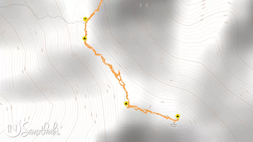
There are several mountain trails leading to the summit of Fengari. The most popular route begins in the village of Therma. Another trail, which is longer, more difficult, and carries a higher level of risk, starts from Chora.
Essential Safety Tips Before You Start
- Do not venture onto the mountain if you are unfamiliar with the island or lack hiking experience. The trail is long and exhausting, with an elevation gain of nearly 1,600m. Parts of the path are poorly marked, and the final ridge section is challenging and potentially dangerous. Every year, hikers get lost and are forced to spend the night on the mountain, often requiring rescue by the local fire department.
- Begin your ascent as early as possible in the morning. This ensures you aren't caught on the mountain after dark and helps you avoid the midday heat during the summer months.
- Pack some food and, most importantly, lots of water. The last water source on the trail is located at approximately 1,000m altitude, and it is often unreliable or unusable.
- Bring a hat, sunscreen, and sunglasses. The final few hours of the trek are across exposed rocky terrain with virtually no shade.
- Pack a windproof jacket. Even if the weather is calm at sea level, Mount Saos is known for sudden, powerful wind gusts along its ridges.
- Carry a portable power bank for your phone - you never know when you might need it. Save several emergency contact numbers, including your accommodation and the local fire department, so you can call for help if needed. (You can find a list of useful numbers on the homepage.)
- Download an offline map and the GPS track (there are several free and paid apps available). Don't rely on your data connection, as mobile signal is weak or non-existent in some areas along the trail.
- Last but not least, always wear specialized mountain trekking shoes with high-grip soles.
Hiking Trail from Therma to Fengari Peak
The village of Therma is the starting point for almost everyone who ventures to climb Fengari Peak.
The trail, which follows the European Long-Distance Path E6, is approximately 8 km long with steep gradients. The round-trip takes about 10–11 hours, depending on your physical fitness and experience (I repeat my advice: do NOT set out for Fengari if you are not accustomed to ridge trails).
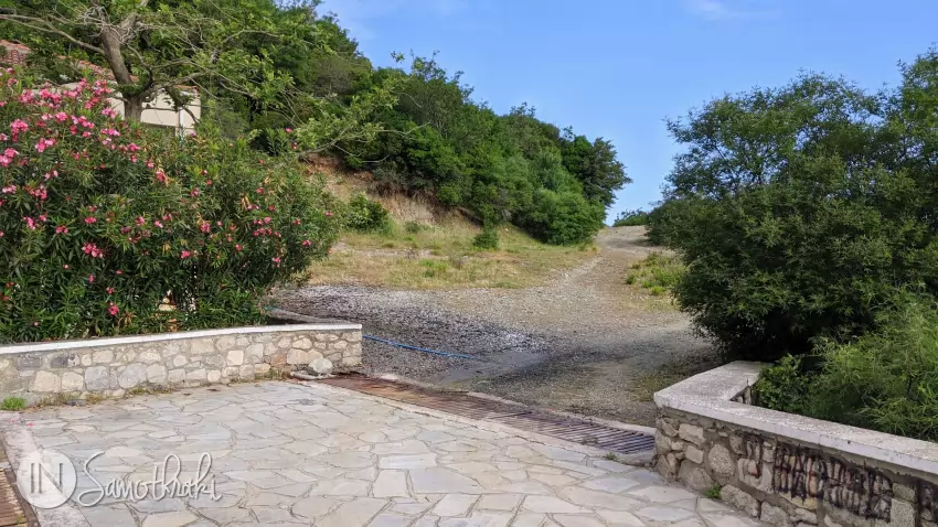
The trail begins at an altitude of about 50m, following the dirt road that climbs to the right of the Municipal Thermal Baths building on Psarotherma Hill. After walking for a few minutes, you will see the open-air thermal pools on the hillside to your right, overlooking the small harbor near Therma Beach.
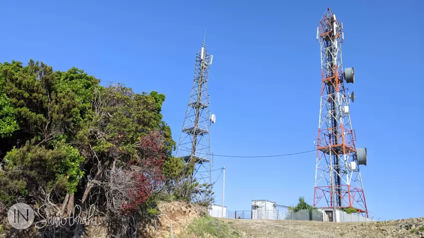
From this point, the road turns sharply to the left, and gravel and boulders become increasingly common. Approximately 25-30 minutes from the start (about 1.4 km in), you will reach the large mobile phone antennas in the fire protection zone, situated at an altitude of roughly 190m.
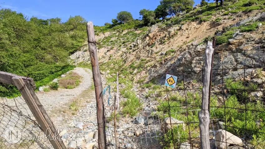
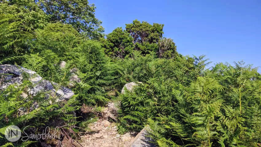
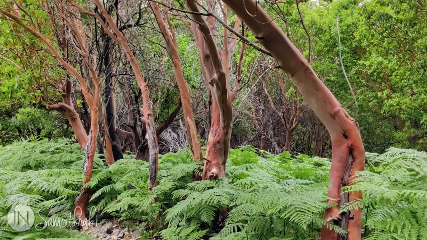
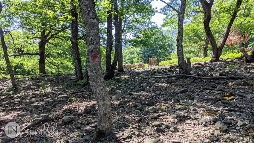
From the antennas, the road continues to climb gently for about 700m (roughly 15-20 minutes) before ending. You are now at an altitude of approximately 290m, where the route transitions into a path winding through ferns and scattered trees. You will soon spot the first trail markers for the E6. Your attention will likely be drawn to the glossy leaves and reddish or smooth, stripped bark (depending on the season) of the Arbutus andrachne (Greek Strawberry Tree).
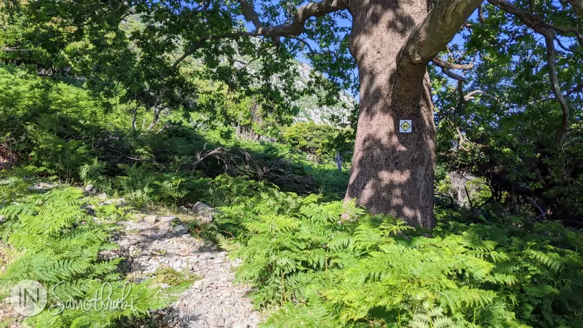
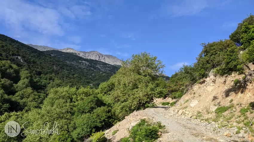
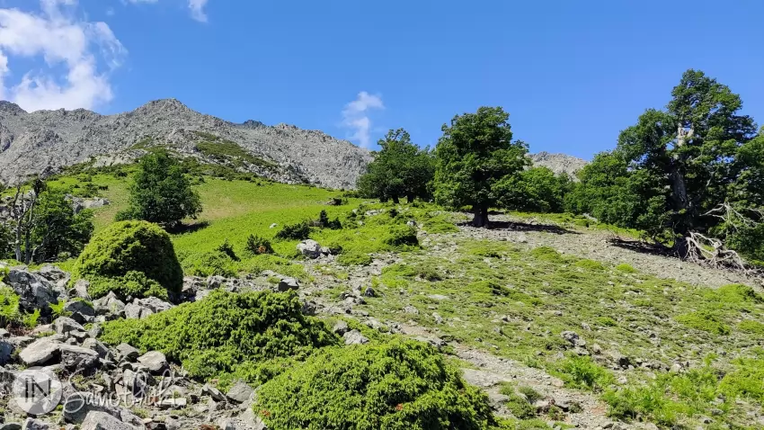
Soon after, you will cross a stream before reaching a steep uphill section. About one hour after leaving the antennas, you will reach an altitude of 500m and enter the Martini Forest - one of the oldest wild oak forests in the Aegean. These ancient oaks are the last remnants of the vast forests that once covered the island all the way to the sea.
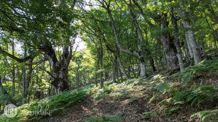
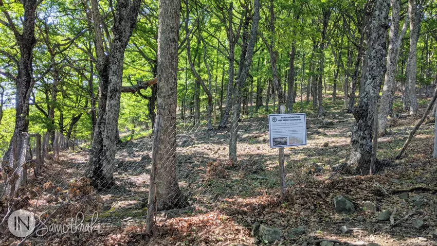
Continue climbing through the forest, following the trail markers. In some areas, you will notice fenced-off sections. These have been enclosed to protect young oak saplings from local goats, which graze on the saplings and prevent the forest from regenerating.
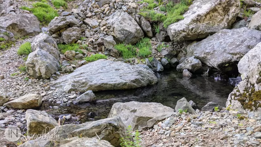
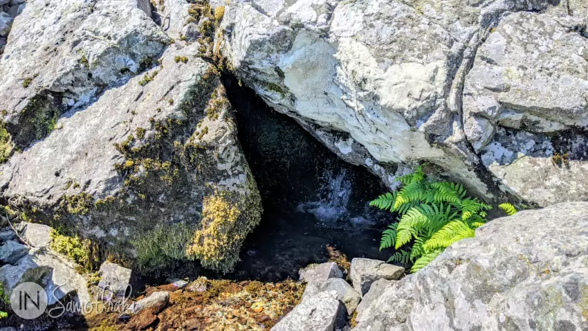
At an altitude of approximately 750–800m, the forest begins to thin out. The path continues to climb for a while before veering left (about 1 hour and 45 minutes after entering the woods), descending into the Tsivdogiannis River valley. You are now at roughly 1,050m elevation. Here, hidden among the rocks, lies the Kalamithria spring, the last water source on the trail. However, it is not recommended to rely on it, as the flow is usually very low, especially during the hot season.
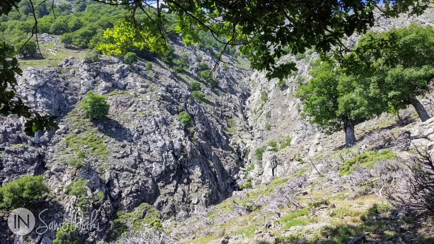
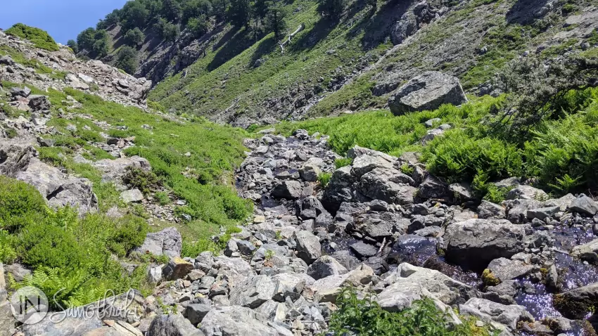
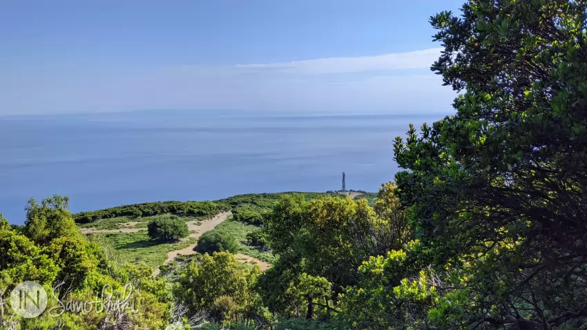
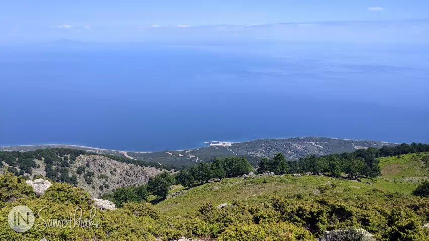
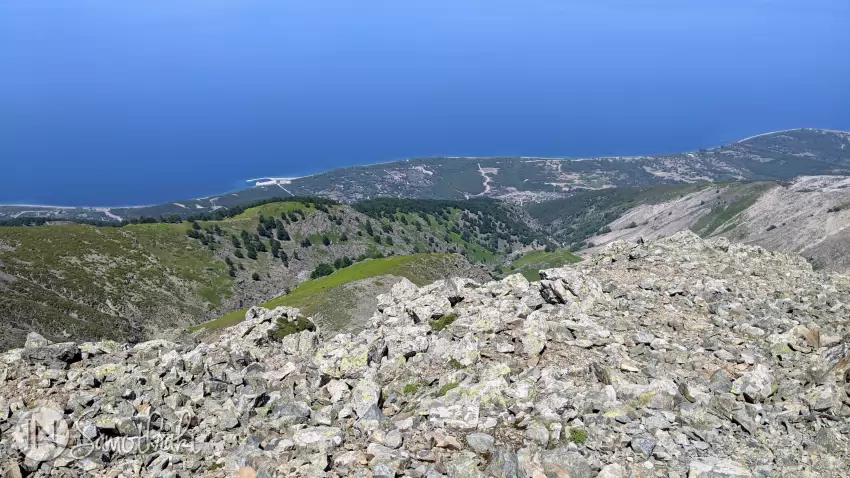
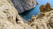
From here, you will cross to the opposite side of the river. In about 20-30 minutes, you will reach the ridge situated between the Tsivdogiannis and Gria canyons. At an altitude of 1,100-1,150m, you will find a clearing with scattered bushes, ferns, rocks and a few lone trees, an ideal spot to pitch a tent if you choose to split the hike to Fengari Peak into two days. From this vantage point, you can look down at the northern part of the island, with a clear view of Therma beach and port.
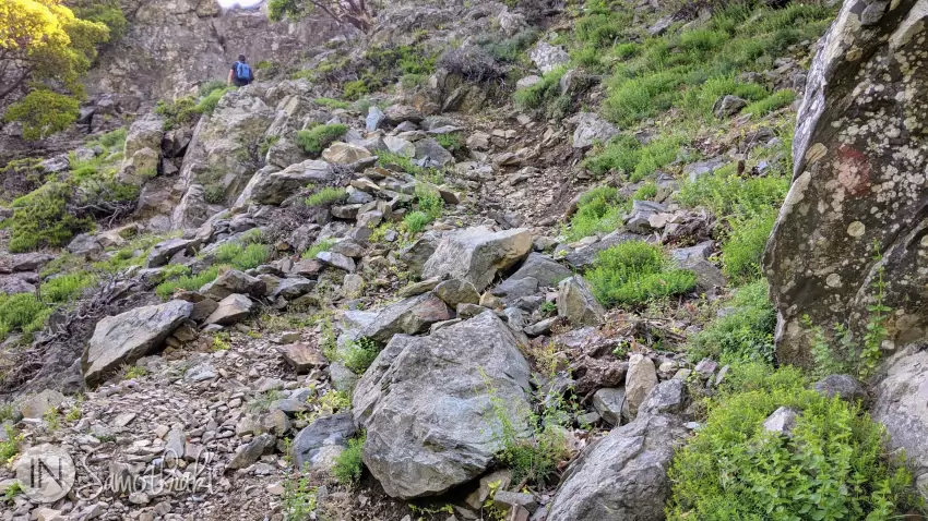
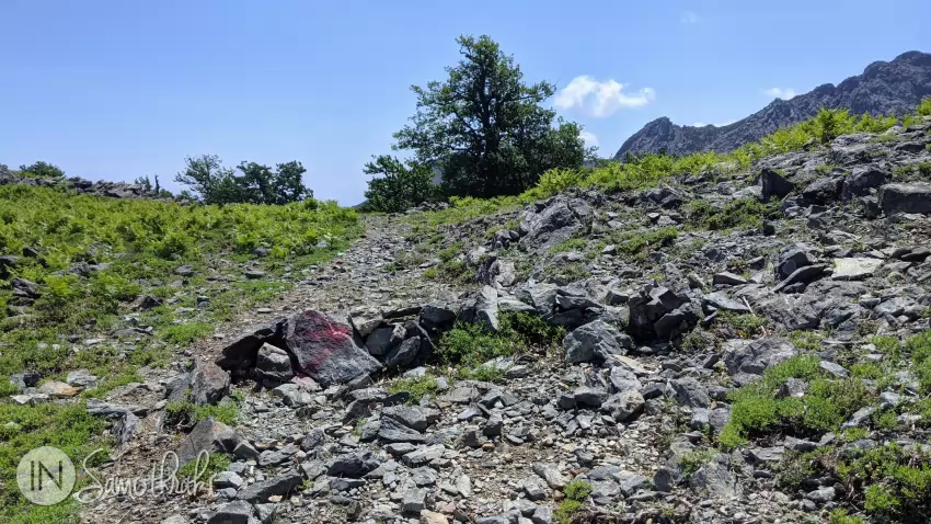
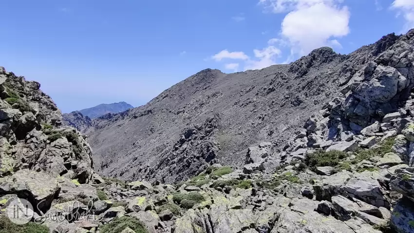
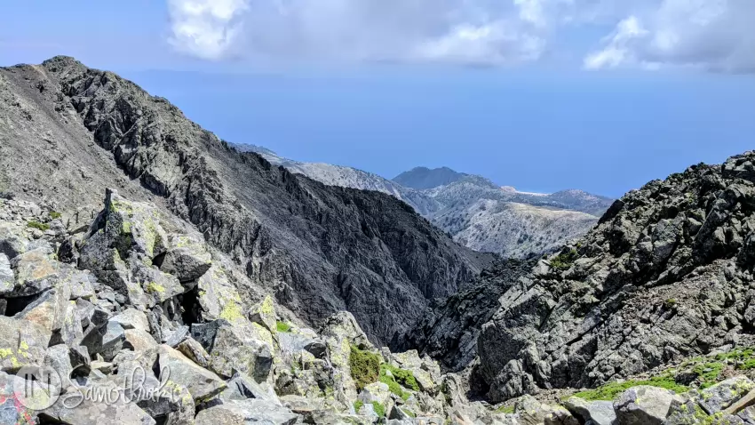
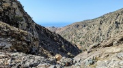
Now the real ascent begins, over challenging terrain under a relentless sun (and sometimes fierce winds). To reach the summit, you will need approximately two more hours. The path, marked by red dots or stone cairns, veers to the right as the vegetation becomes increasingly sparse. By the time you reach an altitude of 1,300m, the greenery is completely replaced by boulders and scree.

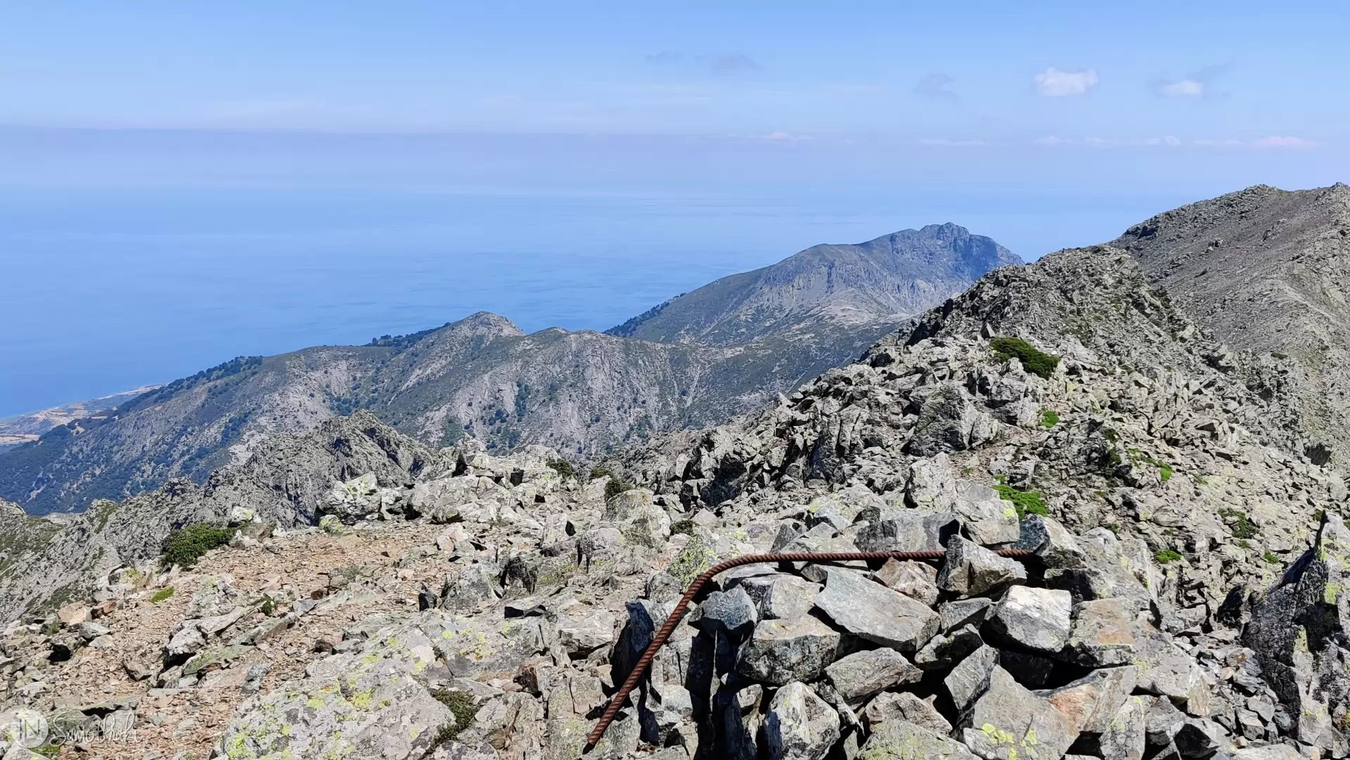
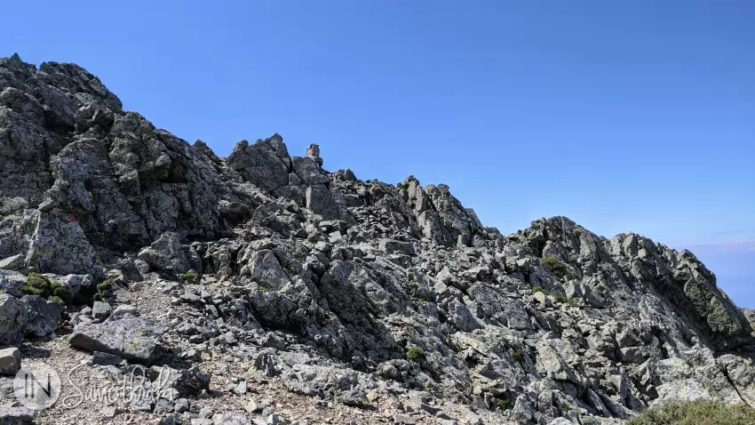
Slightly above 1,500m, you will reach the junction where the trail meets the path climbing up from Chora. Here, the view opens up toward Kamariotissa and the Xiropotamos Canyon. This marks the beginning of the ridgeline, which connects three main peaks. The route becomes quite difficult and, in some places, dangerous. You must pay close attention to the markers, the sometimes unstable ground, and several crossings in exposed areas - where the deep abysses of Mount Saos surround you on both sides.

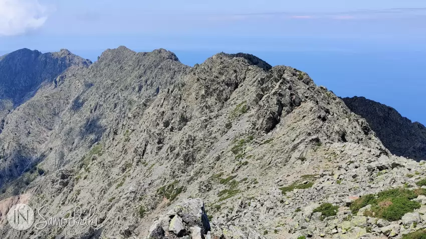
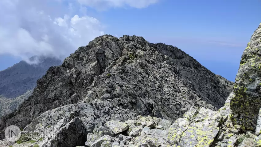
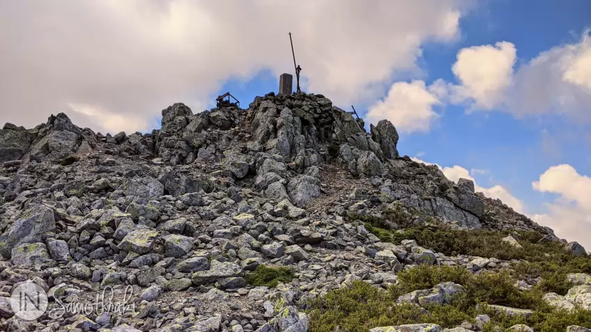
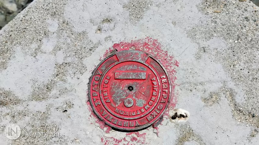
The first peak, marked by a trigonometric pillar built by a group of Bulgarians, sits at an altitude of 1,584m. From there, continuing along the ridgeline, you will reach the second peak in about 20-30 minutes. This one features a geodetic marker with Greek state inscriptions and various pieces of rusted metal scattered around.
Although the trail markers currently lead only to this point - and a small sign has recently been placed here - this is not actually the highest peak on Samothraki. The true Fengari Peak is located about 300 meters further ahead, a few minute walk over relatively flat terrain. You will recognize it by a pile of stones and a bent iron rod. About 15 years ago, it was marked with a metal Greek flag, which has since disappeared.
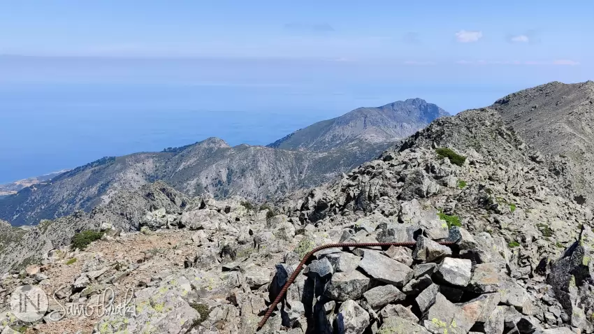
The panoramic view from the summit is spectacular; you can see Pachia Ammos beach, the port of Therma, and Cape Akrotiri near Kamariotissa.
Therma-Fengari Hiking Trail: Quick Facts
- Duration: 10-11 hours (round-trip)
- Distance: Approx. 8 km
- Starting Point: The road to the right of the Municipal Baths in Therma (Altitude: ~50m)
Trail Landmarks (time and distance calculated from the starting point):
- Mobile antennas: ~30 mins | 1.4 km | Altitude: 190m
- End of gravel road, start of fern path: ~45 mins | 2.1 km | Altitude: 290m
- Forest entrance: ~1.5 hours | 3 km | Altitude: 490m
- Thinning forest (fenced areas on right, river on left): ~2.5 hours | Altitude: 780m
- Kalamithria Spring: ~3 hours | 5.6 km | Altitude: 1,050m
- Start of the ridge ascent: ~3.5 hours
- Fengari Peak (summit): 5-6 hours

 The Waterfalls and Vathres of Samothraki
 Mount Saos of Samothraki
 Boat Trips in Samothraki
 11 Things to Do in Samothraki
 Where the Island Ends: Akrotiri Cape and Agios Andreas Lagoon
Have you been there?
Tell everyone about your experience!